Description text from the city:
The Ryding Lands Study will establish a planning framework for how the area will grow and change over time, including an appropriate mix of land uses, supporting infrastructure and community services, and connections with the wider community. See below to learn more and to get involved.
Background
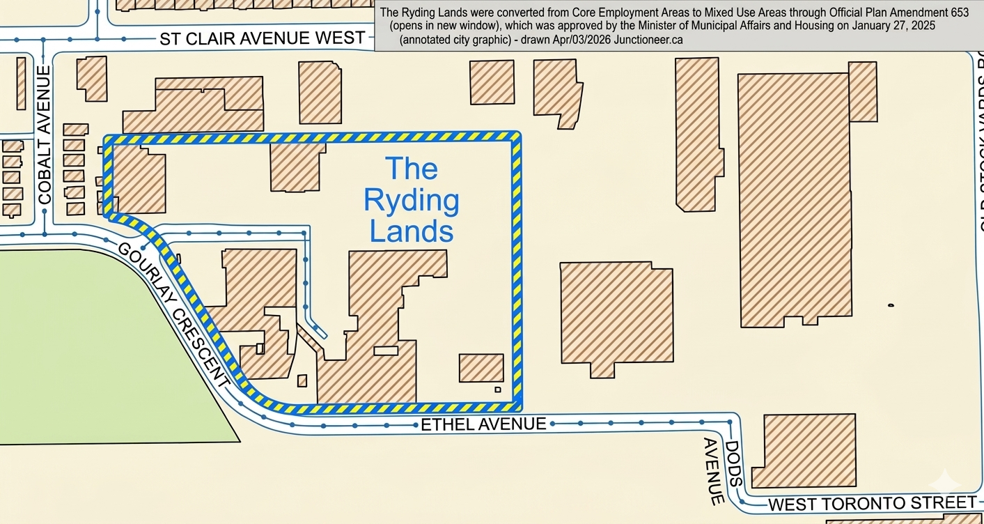
The Ryding Lands were converted from Core Employment Areas to Mixed Use Areas through Official Plan Amendment 653, which was approved by the Minister of Municipal Affairs and Housing on January 27, 2025. This resulted in Site and Area Specific Policy (SASP) 832, which sets out Local Area Study requirements for the Ryding Lands.
Adjacent sites were also converted to Mixed Use Areas through various processes, including:
Part of 2129-2161 St. Clair Avenue West and 10 Old Stock Yards Road (SASP 785) through OPA 742 (opens in new window); and
87 Ethel Avenue through a Council settlement regarding an appeal to OPA 231.
The outcomes of the Local Area Study will update or replace SASP 832.
Study Area
The lands subject to SASP 832 are 3.15 hectares (7.78 acres) in size and comprise properties known municipally as 99, 109, 116, 116R and 126-142 Ryding Avenue and 90 Ethel Avenue. These lands will be the focus of the Ryding Lands Study. The study area boundary is yet to be determined.