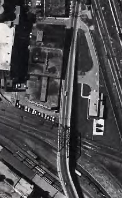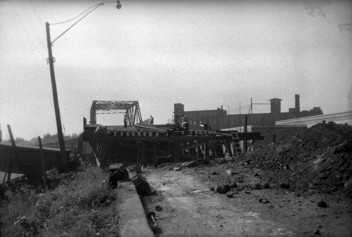
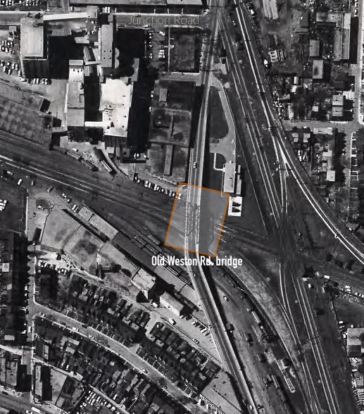
Old Weston Road., bridge the industrial road link to the city core Old Weston Rd., in 1951 looking south from south of Monarch Rd., showing construction of new north ramp to bridge over C.P.R. tracks.
The bridge crossed the railroad tracks to a short section of roadway to the Dundas/Dupont/Annette intersection. After the bridge was closed the you could walk over it and look down though the cracks the connection points of the level bridge roadway and the ramps on either side. Down under the north ramp, accessible from Monarch Rd, you could park under the remaining ramp for decades.
 above, Salmon, James V. (James Victor) (photographer)
below from the cities aerial photographs of the area,